Nagasaki Maps and Orientation
(Nagasaki, Kyushu, Japan)
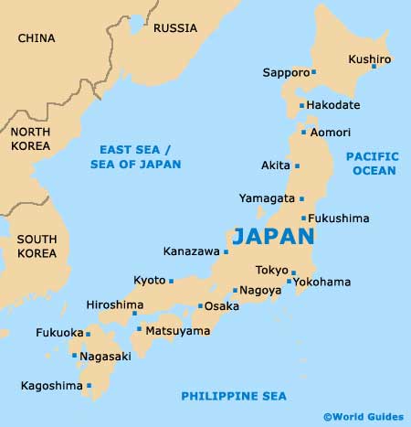
The biggest and most important city within the Nagasaki Prefecture, Nagasaki is actually the capital city and is located on the island of Kyushu, at the far end of Japan's archipelago. Situated at the opening of a scenic bay, Nagasaki is known for its impressive harbour and features an appealing mixture of both residential areas, commercial districts and mountainous areas.
Nagasaki lies alongside two winding rivers, which have formed surrounding valleys and areas of natural beauty. The city's port has been in operation for more than 200 years and has brought considerable wealth to the region, and is now one of the most visited cities in the whole of Japan, being especially tourist friendly.
Maps and Orientation of the City
For useful English-language city maps, the Kinokuniya bookstore is a good resource and can be found along Motofune-cho in the Yumesaito Building. Both the Hamano-manchi Arcade and the Nagasaki Station are useful points of reference within the city centre, together with the entertainment district of Shian-bashi.
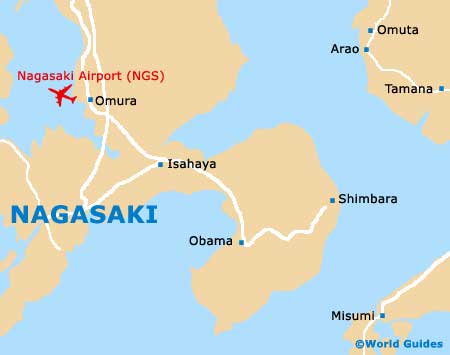
Nagasaki is especially close to China and South Korea, which lie to the west and north-west respectively. Close to Nagasaki are a number of neighbouring towns and cities, which make interesting day trips. Of particular interest are Isahaya,
Nagayo, Saikai and Tokitsu, while other choice locations include:
- Dazaifu - north-east
- Fukuoka - north-east
- Hondo - south-east
- Karatsu - north
- Kumamoto - east
- Kurume - north-east
- Maebaru - north
- Matsuura - north
- Misumi - south-east
- Obama - east
- Omura - north
- Saga - north-east
- Sasabo - north
- Sendai - south
- Ureshino - north
- Ushibuka - south
Map of Japan
Map of Nagasaki